My Blog
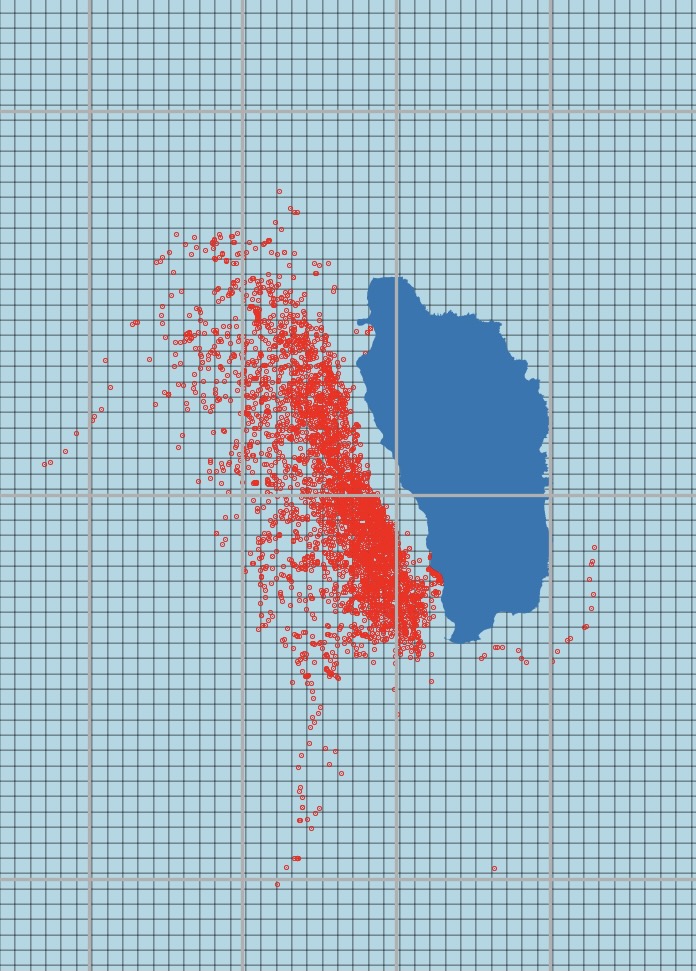
Protecting Whales from Ships
This Python analysis uses whale sightings and vessel data to suggest a speed reduction zone for the coast of Dominica.

Analyzing Air Quality Trends in the US with EPA AQI Data
For our Remote Sensing final project, my group and I analyzed air quality trends in the US, and California more specifically, by using AQI datasets from the EPA.
Intro to Maps
Using `tmap` to create static and interactive maps.

Are California Wildfires Getting more Intense in the North or South?
EDS 222 Final Project: Exploring geographic trends of wildfire intensity in California over time

Using an API to Programmatically Access and Download Data
Using the `dataRetrieval` package to analyze USGS datasets
Two weeks as a MEDS student
A few functions I learned and key takeaways from my first two weeks in MEDS

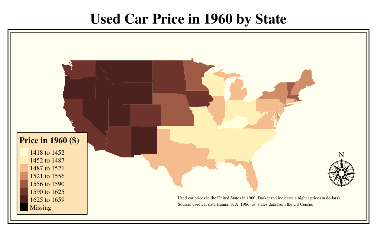
Working with `ggplot`
Using `ggplot` with the `palmerpenguins` package